Zambia Road Safety Trust
The Kafue–Chirundu Corridor: A Crisis We Can No Longer Ignore
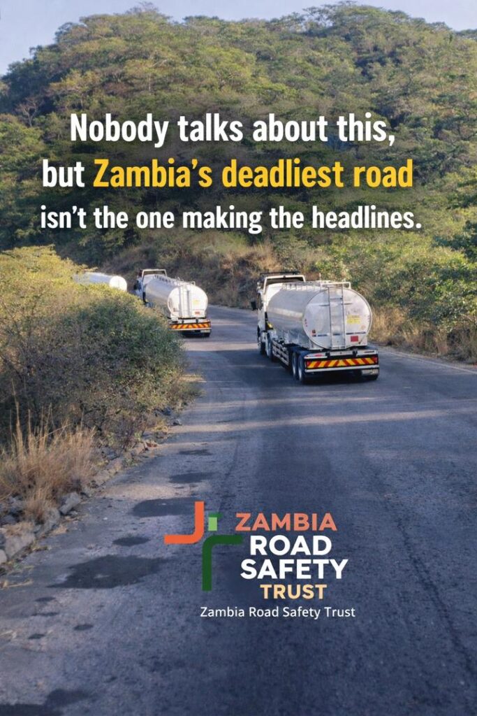
THE
FORGOTTEN
CORRIDOR
Corridor safety brief
Kafue, Chirundu Corridor, Road Safety Risk Brief
The Kafue, Chirundu corridor is a short but high consequence section of Zambia’s trunk road network. ZRST is calling for a focused safety response based on crash evidence, road design risk, truck and bus exposure, emergency response gaps and the strategic importance of the route.
National context
Corridor safety is central to Zambia’s road safety challenge.
Inter district and trunk road crashes have a serious human and economic cost. High speed roads, heavy vehicles, long distance buses and delayed emergency response can turn individual crashes into mass casualty events.
Corridor comparison
A short section of road with concentrated safety risk.
The Kafue, Chirundu section is approximately 92 km long. Publicly reported mass casualty crashes and ZRST corridor records indicate a need for dedicated engineering, enforcement and emergency response measures.
Kafue, Chirundu Corridor
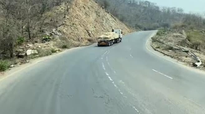
This corridor includes steep terrain, high truck and bus exposure, crash prone sections around the escarpment, and limited dedicated safety infrastructure.
- Approximate corridor length, 92 km
- Confirmed major incident deaths, 37 plus, 2020 to 2026
- High consequence crash locations around Kapiringozi and Kapilingozi
- Limited emergency response coverage along the route
Great North Road
The Great North Road has a much higher public profile and is frequently discussed in national road safety debate. The Kafue, Chirundu corridor receives less attention despite its concentrated risk profile.
- Approximate length, 900 km
- High public and media attention
- Important national and regional trade route
- Useful reference point for corridor risk comparison
Documented incidents
Selected publicly reported crashes on the Kafue, Chirundu corridor.
The incidents below are selected examples from public reporting and ZRST corridor review. They show the type of risk that requires infrastructure, enforcement and emergency response action.
A bus carrying church members from Chongwe collided with a truck. Survivors were taken to the University Teaching Hospital. Preliminary reporting cited driver negligence.
A light truck carrying passengers reportedly developed brake failure while descending Kapilingozi Hills and struck a Volvo truck. Several people were seriously injured.
A passenger bus overturned near Kafue Boys Secondary School junction. Public reports cited excessive speed and loss of control.
An Iveco truck transporting building materials reportedly failed to negotiate a curve due to excessive speed, entered a ditch and overturned.
Risk factors
Three issues increase the severity of crashes on this corridor.
Corridor safety requires more than driver warnings. It requires road engineering, speed management, vehicle safety controls, commercial transport oversight and post crash response capacity.
Escarpment terrain
Steep gradients and curves around the escarpment create risk for heavy vehicles, especially where braking systems are weak, vehicles are overloaded, or drivers are travelling too fast for the road environment.
Heavy transit traffic
The corridor carries trucks, buses and light vehicles on a regional route connecting Lusaka with Zimbabwe and South Africa. Differences in vehicle mass, speed and stopping distance increase crash severity.
Emergency response distance
Serious crashes on the corridor can occur far from advanced emergency care. Delays in rescue, stabilisation and transfer can worsen outcomes for injured passengers and drivers.
Limited protective infrastructure
Key sections require stronger safety treatment, including barriers, warning signs, speed management, rest areas, enforcement points, and emergency access planning.
Recommended actions
ZRST recommends a targeted corridor safety response.
The Kafue, Chirundu corridor should be treated as a priority section for engineering review, enforcement planning and emergency response improvement.
Road engineering and infrastructure
- Install crash barriers at high risk escarpment sections
- Assess the need for runaway lanes on steep descents
- Improve warning signage, road markings and delineation
- Carry out a published road safety audit of the full corridor
Speed and vehicle controls
- Strengthen speed enforcement at high risk points
- Review truck and bus compliance on braking and loading
- Introduce targeted enforcement at Kafue junction and corridor entry points
- Publish corridor level crash and enforcement data
Emergency response
- Establish a corridor emergency response point
- Map ambulance access points and transfer routes
- Equip first responders for mass casualty incidents
- Coordinate emergency planning with hospitals, police and RTSA
Public accountability
- Publish a corridor safety action plan
- Assign lead agencies and timelines
- Report quarterly on progress
- Engage transport operators, truck owners and bus companies
Partner role
How partners can support safer corridor outcomes.
Companies, insurers, logistics firms, donors, embassies and technical partners can help turn this corridor brief into a practical programme of action.
Fund a corridor road safety audit
Support an independent technical assessment of road design, speed risk, crash locations, signage, barriers, emergency access and heavy vehicle exposure.
Support emergency response readiness
Fund equipment, training, coordination protocols and a corridor emergency response plan for high consequence crash locations.
Improve fleet and driver safety
Work with transport operators to address fatigue, speed, vehicle maintenance, loading, braking and route risk management.
Support public data and monitoring
Help ZRST and partners publish corridor level safety evidence, track safety actions and report progress to the public.